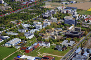
Against the sinking of the rice chamber of Vietnam
- TU News
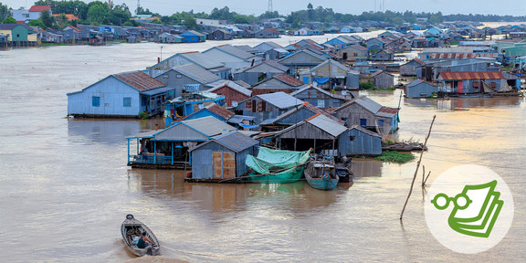
In the Mekong Delta in Vietnam, food is grown for around 200 million people. But climate change is threatening the region: rising sea levels and extreme weather events such as droughts and typhoons are leading to drinking water shortages and crop failures. Prof. Nguyen Xuan Thinh is researching how land and water can be used more sustainably.
The south of Vietnam is crisscrossed by a labyrinth of rivers, swamps and canals: the Mekong Delta. Before the Mekong flows into the South China Sea, it branches out here into numerous river arms, some of which are interconnected. The fertile area is home to 17.3 million people - and feeds around 200 million people throughout Southeast Asia. Because rice is the main crop, the Mekong Delta is also known as the "rice bowl of Vietnam. But the Mekong Delta is affected by climate change as few other areas. The 720-kilometer coastline makes the region vulnerable, and protective mangrove forests have been cut down in many places.
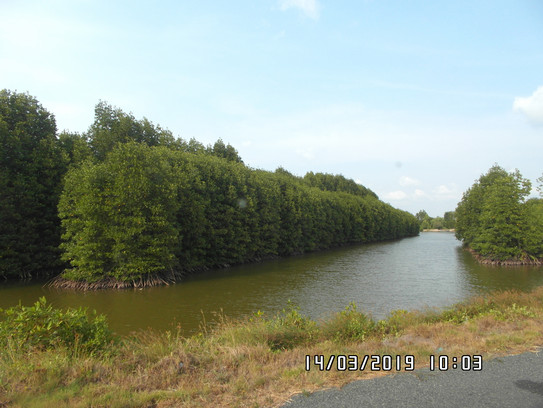
The consequences: Natural disasters such as typhoons, floods and persistent droughts. The largest city in the Mekong Delta, Can Tho, and nine of the twelve provinces are less than one meter above sea level. If the sea level rises, the Mekong Delta can hardly be protected with dams and weirs. In addition to climate change, the industrial use of the Mekong is also a problem: hydroelectric power plants in countries such as China or Laos prevent small particles of stone and sand from reaching Vietnam with the river and being deposited there. Without these sediment deposits, more and more stretches of coastline and riverbanks are being washed away, in many places as far as 50 meters.
"Sea level rise, land subsidence and long dry periods are causing large amounts of saltwater to enter the Mekong Delta," says Prof. Nguyen Xuan Thinh of the Department of Spatial Planning at Dortmund University of Technology. In 2016, for example, saltwater reached half of the 2.2 million hectares of cultivated land, destroying crops and contaminating drinking water sources. "It is urgent to develop solutions for the Mekong Delta. Otherwise, the existence of the whole area and the habitat for millions of people will be at risk," Thinh said.
The BMBF is funding the research project
In the ViWaT-Planning project, Thinh is investigating the consequences of climate change for the Mekong Delta and what suitable strategies for the most sustainable possible water and land use might look like. To this end, the scientists of TU Dortmund University are working together with other German research institutions as well as with partners from industry and Vietnam. ViWaT-Planning is coordinated by the Ruhr-University Bochum and is an independent sub-project within the joint project ViWaT-Mekong. The German Federal Ministry of Education and Research (BMBF) is funding ViWaT-Mekong in the program "Client II - International Partnerships for Sustainable Innovation" until the end of 2021. Around two million euros will go to ViWaT-Planning; other subprojects are ViWaT-Engineering and ViWaT-Operation.
Together with his research group from the Department of Spatial Information Processing and Modeling, Thinh is responsible for finding out how people manage the land in the Mekong Delta and what alternative scenarios might look like. "We map the water-related land use of the Mekong Delta and store all the information in a geodatabase. This data will later form the basis for a regional land use plan," says Thinh.
To do this, the scientists mainly analyze Landsat and Sentinel satellite images. Landsat Earth observation satellites are operated by the U.S. space agency NASA, Sentinel satellites by the European Space Agency ESA. In addition to optical data, they also provide radar data - for this purpose, the satellite scans the Earth's surface with electromagnetic waves and generates a three-dimensional representation of the terrain.
Even as the project was being prepared, Thinh and his team were able to show, for example, how much land is actually being washed away: The Mekong Delta loses about 450 hectares - or 4.5 square kilometers - of land to erosion each year. "Until now, Vietnamese authorities had to take such measurements manually. Our method is not only more accurate, but also much faster," says Thinh.
Satellite imagery provides an accurate picture of land use
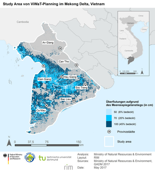
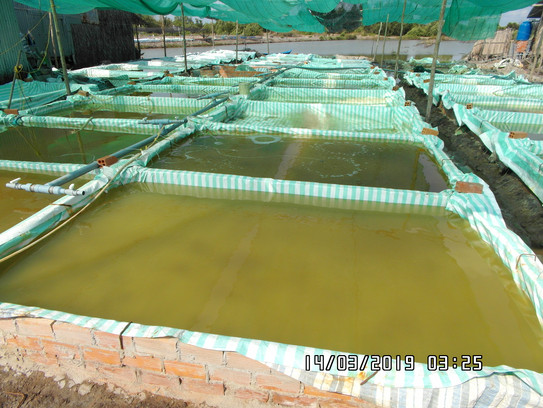
With the help of the satellite images, the researchers can find out which foods are produced where and at what time of year. In addition to rice cultivation, the Mekong Delta contributes primarily to aquaculture for fish or shrimp and to fruit and vegetable production. While individual provinces have so far provided this information, the data is for different time periods and does not compare well. Because Thinh and his team work with satellite imagery, they are able to provide up-to-date and comparable information.
The analysis works computer-aided and is supplemented by field research in the field: for example, photos tagged with GPS coordinates or drone footage. These data serve as a match for the results based on the analysis of satellite imagery. And they are fed as training pixels into the analysis program, which thus learns how to interpret the data from the satellite images.
"We use mapping to show possible scenarios for land use," says Thinh. "For example, if rice is to be grown at a site, local decision-makers can draw on our research. The geodata then show, for example, how great the risk is of seawater entering that site - and how the site could be used more sustainably."
A major problem in the Mekong Delta is the lack of regional planning. There are many individual plans in each province without integrating them into an overall plan. "For example, if a province decides to grow shrimp instead of rice in one place, it has to bring in saline water to do so. But that affects the neighboring province's rice cultivation. So it doesn't make sense for each province to do its own planning," Thinh says. The goal of ViWaT-Planning is to develop methods for strategic planning across provinces. The researchers from the other participating universities are looking at other important factors besides land use, such as drinking water supply, wastewater management and the quality of groundwater and surface water.
A regional plan helps with climate-related problems
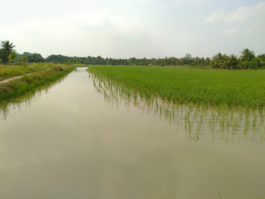
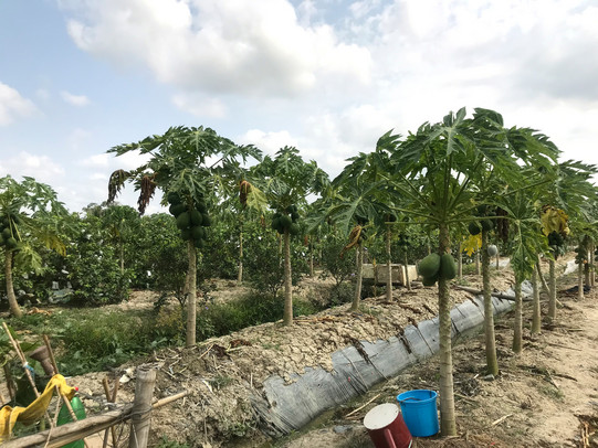
The regional plan is intended to help Vietnamese decision-makers respond better to climate-related problems. So far, attempts are still being made to hold back the seawater with a system of dikes and weirs, and tanker trucks supply the Mekong Delta with drinking water during periods of drought. At the same time, water resources are not being used optimally in some cases: Water bodies are overfished, too much groundwater is extracted, or surface water is polluted. "A better strategy would be to use seawater as a resource, for example in aquaculture, or to switch to water-efficient agriculture and resilient fruit varieties," Thinh says. "Optimizing land and water use and adapting to the changing climate is a very important step." Other solution strategies include developing ecological tourism or environmentally friendly industries, especially for processing agricultural products.
For ViWaT-Planning, the scientists are working closely with the local authorities. They have already coordinated the preparation of the project in detail, for example during a workshop in Vietnam. This was to ensure that the project would be as profitable as possible for everyone involved. "It is very important to me to develop strategies not only for the local decision-makers, but with them," says Thinh. "The collaborations on the ground, but also the collaborations with our German partners from industry and other research areas, are what make the project so exciting."
In principle, the results can be used to monitor other river deltas, such as the Ganges in India and Bangladesh, the Nile in Egypt or the Amazon in Brazil. Thinh's research also shows that it is possible to build modern geodatabases for developing countries in a short time.
In his work, however, what drives Thinh most is the Mekong Delta itself - and the opportunity to contribute to its conservation. "I read books about the Mekong as a child and was fascinated by the region and its diversity. Today, this fertile alluvial land has changed significantly: due to the construction of power plants, industrialization and, above all, climate change. If we don't change anything, the Mekong Delta will simply be swallowed up by the sea."
Text: Hanna Metzen

About the person
Prof. Nguyen Xuan Thinh has been Professor of Spatial Information Processing and Modeling at the Department of Spatial Planning since 2011. He studied mathematics at the Technical University of Dresden and received his PhD in computer analytics and computer algebra. In 2005 he habilitated at the University of Rostock and was subsequently a private lecturer in geodesy and geoinformatics. Since 2012, he has been a visiting professor at the China University of Mining and Technology. At TU Dortmund University, he investigates how spatial data can be analyzed and spatial systems modeled: His research focuses, for example, on geoinformatics, remote sensing or modeling based on geographic information systems.

